Preview of ErControl 3.1.0
The upcoming version 3.1.0 reworks topographic training: the route is shown on a map, and while riding you see both your surroundings and the course of the route. The screenshots show the current state of development; details may still change before release.
Key features
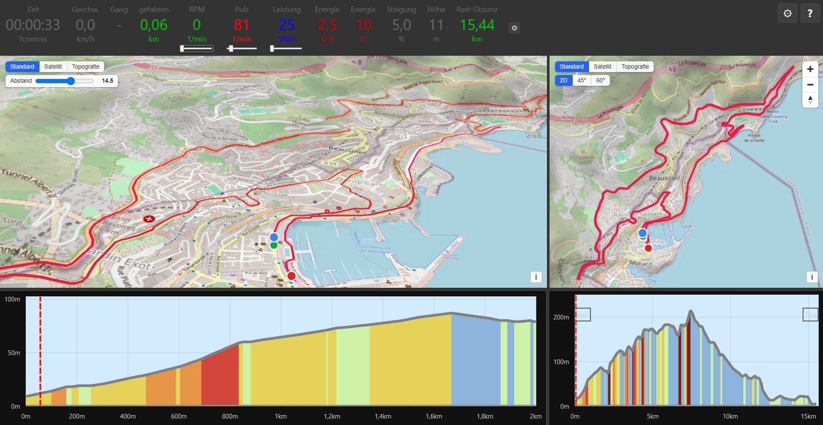
- 3D terrain view with OpenStreetMap maps (standard, satellite, topography): the map can be panned, rotated and tilted, and a driver's view follows the route in real time.
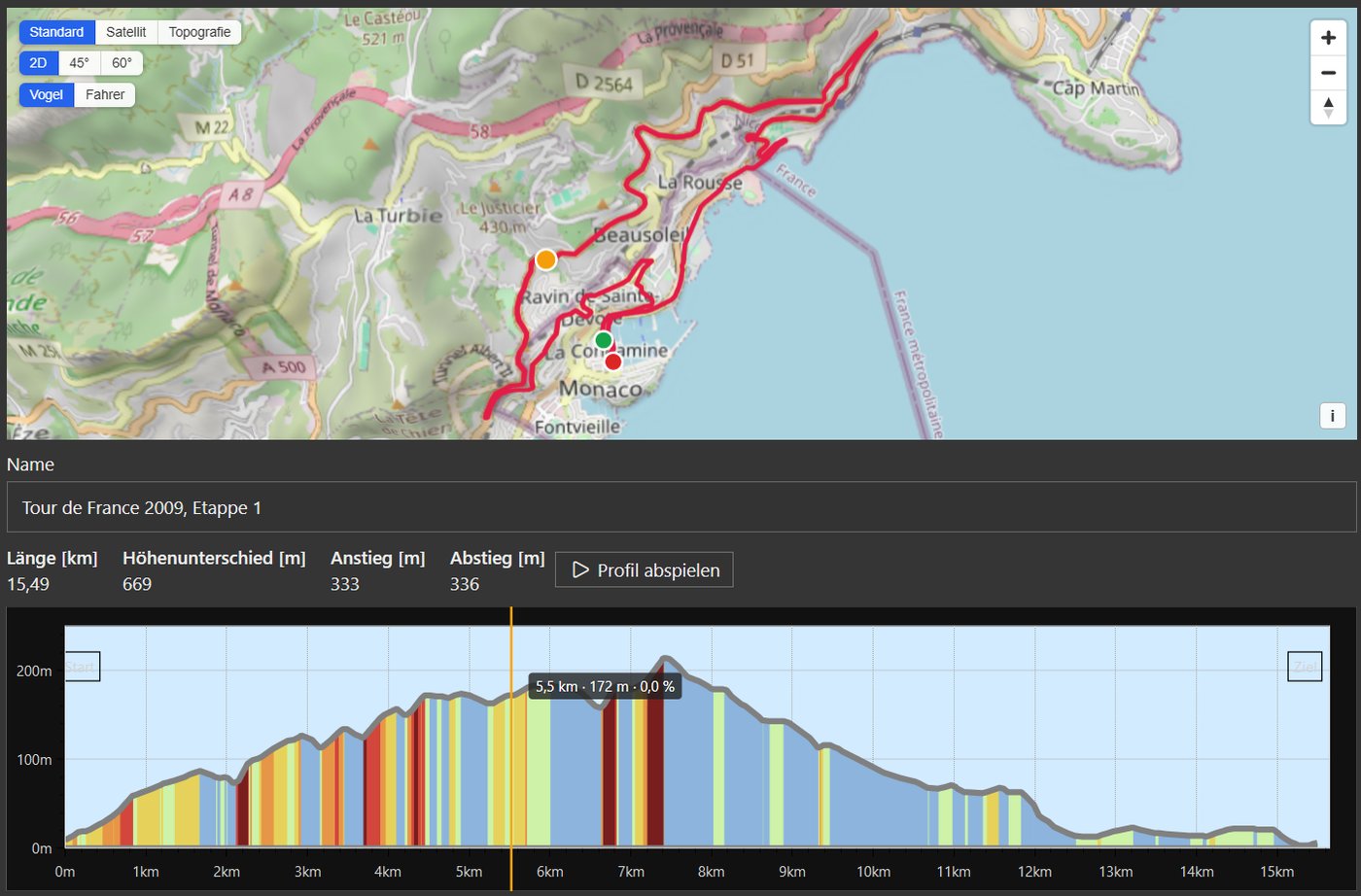
- Start distance instead of stages: before training you choose the starting point by clicking the elevation profile or entering the kilometers; a profile can be continued from the last ridden position.
- Elevation profiles adapt the elevation axis to the actual elevation range of the route.
- The values bar in the training window can be scaled in percentage steps.
- Settings during training: an overlay panel lets you adjust, for example, the gear shifting without interrupting the training.
-
A help button (
?or F1) shows the keyboard shortcuts available in the current training.
Profile overview
Before training, the overview shows the route on a map (standard, satellite or topography, either in 2D or as a 45°/60° view) together with length, elevation difference, ascent and descent. The elevation profile is colored by gradient, and “Play profile” lets you preview the route.
Training
During training, ErControl shows a close-up of the route with an adjustable distance on the left and the whole route on the right. Below each map is the matching elevation profile: the section right ahead of you and the complete route. The current values are shown in the header as usual.